Coastal & Foreshore
Emu Point to Middleton Beach Coastal Hazard Risk Management Adaptation Plan (CHRMAP)
Emu Point to Middleton Beach CHRMAP Summary
At the City of Albany Ordinary Council Meeting on the 17th December 2019, Council adopted the City’s first Final Coastal Hazard Risk Management and Adaptation Plan (CHRMAP) for the Emu Point to Middleton Beach area. The Final CHRMAP combines all of the relevant information from the CHRMAP process into one final report, including all the relevant reports and feedback from the community. A copy of the final CHRMAP report can be found below:
CHRMAP Implementation Plan
The CHRMAP Implementation Plan is a succinct easy to read standalone document that provides an overview of the CHRMAP process and details the recommended management options for the key assets at risk.
Emu Point to Middleton Beach CHRMAP Implementation Plan FINAL
CHRMAP & Appendices
Emu Point to Middleton Beach CHRMAP Final
Emu Point to Middleton Beach CHRMAP Appendices
Public Comment Summary and Response
Emu Point to Middleton Beach Public Comment Summary and Response
The City’s Final CHRMAP report has resulted in 11 recommendations which are contained in the CHRMAP document and Implementation Plan. These recommendations will enable the City to make more informed coastal management decisions in the future and provide direction for how the City’s coastal hazard risks will be managed until the next review is required. The City’s CHRMAP will be updated and reviewed every five to ten years, and in accordance with the State Planning policy 2.6
State Planning Policy No. 2.6
State Coastal Planning Policy Guidelines
Background
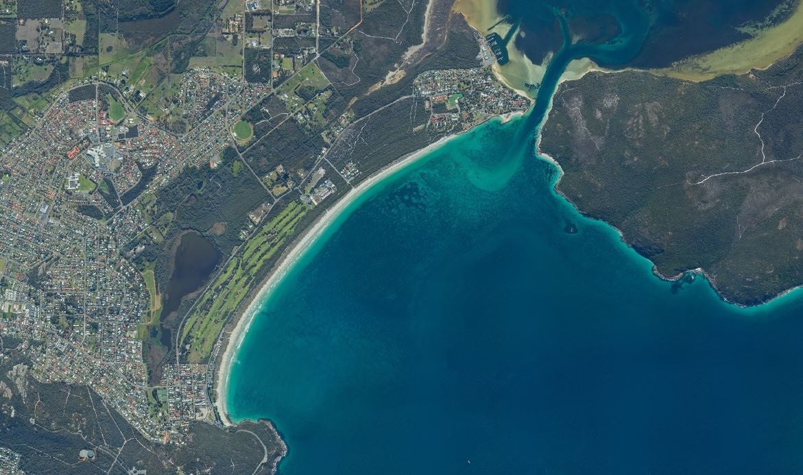
The City of Albany prepared a CHRMAP for the area of coast from Ellen Cove to the Emu Point Boat Pens. The CHRMAP was completed in accordance with State Planning Policy 2.6: State Coastal policy and associated guidelines. This is the first CHRMAP that has been completed for the City of Albany. This CHRMAP is designed to identify coastal inundation and erosion hazards for the project area and recommends controls to manage and mitigate the risks, when they should be implemented and what the impact will be in terms of effectiveness, cost environmental and social impact and reversibility. The CHRMAP is based on extensive technical background research and investigations, community and stakeholder values and inputs, recognition of strategic planning and governance interventions available to the City and the need for culturally and economically acceptable outcomes.
CHRMAP Background Documents
Coastal Vulnerability Study Evocoast
Background Documentation Hazard Mapping Study
What's Next?
The City will continue to monitor the project area. The monitoring framework is contained within the CHRMAP document. The City’s CHRMAP will be updated and reviewed every five to ten years, and in accordance with the State Planning Policy 2.6 and associated guidelines. As a recommendation of the CHRMAP the City has developed a Foreshore Management Plan for the Emu Beach area.
CHRMAP Monitoring Plan Final
Emu Point to Middleton Beach CHRMAP Monitoring Plan
City of Albany Photo Beach Monitoring
The Emu Point to Middleton Beach Photo Monitoring Program was developed in 2014 as part of the Emu Point to Middleton Beach Coastal Adaptation and Protection Strategy. This strategy covers the coastal system that includes Oyster Harbour, Emu Point and Middleton Beach. The development of the Strategy was important to gain community input; assess all previous studies; identify gaps in the data and fill them; understand the values and essential character of the coastal region; and to identify viable management options for short and long term. The Emu Point to Middleton Beach Photo Monitoring Program is designed as a simple, inexpensive, scientifically valid, long range data gathering exercise, easily learned and maintained, easily expanded or contained, and engaging interested community members as volunteers. Outcomes of the program include:
-
Contribute to a detailed database of coastline change for the area of coast from Ellen Cove (Middleton Beach) to the Emu Point Boat Pens;
-
Collect data that will inform present and future management decisions for this area of coast;
-
Provide data in an easily usable, retrievable and compatible form for local, regional, state and national data gathering;
-
Begin a historical process that can be taught to and handed on to future generations; and provide a model of data collection that can be applied to other areas of coastline.
View the data here: Emu Point to Ellen Cove Beach Monitoring
Oyster Harbour Foreshore Management Plan (FMP)
This Foreshore Management Plan (FMP) covers the areas in Oyster Harbour from the Emu Point Café to the Emu Point Marina.
The FMP was the next step after completion of the Coastal Hazard Risk Management and Adaptation Plan (CHRMAP) for the stretch of coastline between Middleton Beach and Emu Point. This area of coast is highly valued for its social, environmental and economic aspects, and this FMP has been developed in consultation with the community and stakeholders.
The study area includes the coast and adjacent parks, beaches, playgrounds and car parks between Emu Point and the boat ramp.
The FMP provides detail on coastal management actions in line with the CHRMAP and also includes concept plans for future precinct developments. Technical support was provided from engineers, landscape architects, town planners and City staff.
If you would like more information about the project, please contact the City of Albany on (08) 6820 3000 or email [email protected]
Oyster Harbour Foreshore Management Plan (FMP) Final
Oyster Harbour FMP Engagement Outcomes
Emu Beach Foreshore Management Plan
The City has produced a Foreshore Management Plan (FMP) for the Emu Beach and Emu Point areas. This is part of the Emu Point to Middleton Beach Coastal Adaptation and Protection Strategy which the City has been developing since 2013.
Emu Beach Foreshore Management Plan
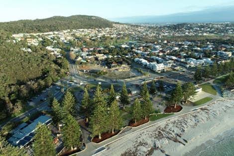
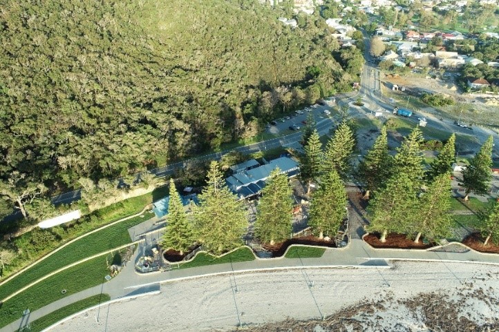
Middleton Beach Foreshore Enhancement
This project was a realisation of the adopted Foreshore Management Plan and a $9 million partnership between the Commonwealth Government, DevelopmentWA (formally known as LandCorp) and the City of Albany.
The project has various benefits to the community's continued use and enjoyment of the foreshore precinct, including coastal protection measures, improved drainage and water treatment, provision of service infrastructure, promenade treatments, enhanced public facilities, access and amenities and event space creation.
Middleton Beach Project Poster
Stage 1 - coastal protection sea wall & civil works - completed 2020
Stage 1 Sea Wall _Information Board
Stage 2 - main carpark extension and enhancement, new service access and disabled access parking to 3 Anchors, and parkland landscape upgrades in Ellen Cove, central and northern promenade, and Albany Surf Club surroundings - completed 2021
Stage 2 Landscape _ Information Board
Stage 3 - Ellen Cove & Amphitheatre Upgrade & Northern Landscape Area (between Big 4 and Surf Club) - completed 2023/2024
Middleton Beach Foreshore Enhancement Nov 2020
DevelopmentWA (formerly Landcorp) Activity Centre
DevelopmentWA Activity Centre Information