Mounts Trails Network
Project Overview Objectives + Outcomes Project StatusTemporary Trail Closures Using the Trails Vehicle Access + Parking Funding + Partners Contact Documents FAQs
Project Overview
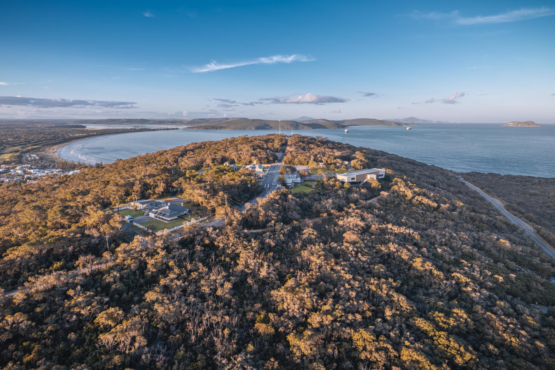
The Mounts Trails Network is transforming the trail network across Irrerup (Mt Adelaide) and Corndarup (Mt Clarence) in Albany Heritage Park. The project will rationalise the existing trail network by closing unsanctioned trails, restoring degraded bushland and constructing a connected network of purpose-built walking, mountain bike and shared-use trails built to contemporary best-practice standards.
Once complete, the network will include approximately 28 km of trails*, combining upgraded existing trails with newly constructed trails.
- 7.6 km of single-use walking trails connecting the existing nature trails across Irrerup and Corndarup.
- 11 km of family-friendly mountain bike trails - purpose-built green, blue and black trails for beginner to experienced riders.
- Nearly 9 km of shared-use pathways for walkers and cyclists connecting key heritage attractions and recreational destinations.
The trail network connects Binalup / Middleton Beach, the National Anzac Centre, Princess Royal Fortress, Albany's historic CBD and the waterfront, creating safe, family-friendly recreation while protecting the Mounts' nationally significant natural, cultural and military heritage.
*This figure excludes unclassified firebreaks, management tracks and informal trails that are not part of the recreational trail network.
Objectives + Outcomes
- Creating exceptional recreational cycling and hiking pathways, connecting and enhancing liveability and tourism experiences
- Support the attraction and retention of existing & new residents, families and youth
- Value-adding to the National Anzac Centre experience
- Providing properly designed and sanctioned trails to obviate the need for user groups to construct their own
- Providing an extensive revegetation project to rehabilitate degraded areas of bushland and unsanctioned trails
- Development of a balanced, site responsive trail network system (walkers and riders) - linking major destinations, neighbourhoods and activity nodes within the city, and catering to a range of different trail users, styles, levels of difficulty and experience (active, passive, heritage, nature) - whilst ensuring the protection of the site’s environmental, cultural and heritage values.
- A single-use link MTB link trail network through Mt Clarence (Corndarup) + Mt Adelaide (Irrerup) connecting surrounding precincts of Middleton Beach, City Centre and Waterfront and linking geographical features to provide fun and challenging experiences. The trails will cater for beginner to intermediate riders.
- Single use link trails for walkers along the northern slope of the ridge, connecting Mt Clarence (Corndarup) + Mt Adelaide (Irrerup) nature trails.
Project Status
The Mounts Trails Network has now progressed into the construction phase, with the first stages of the network complete and the Botanic Link and additional walking trail connections and environmental rehabilitation continuing through 2026 and into mid 2027.
Click here for map of the trail network, including the current status of each trail.
Easy (Green)
Family-friendly trails designed for beginner riders with gentle gradients and limited technical elements.
- Irrerup Mountain Bike Descent/Climb
Complete & Open
- Mountain Bike Ridge Trail - Easy
Complete & Open
Intermediate (Blue)
Trails designed for intermediate riders and featuring sections of technical, rocky terrain that provide a challenging and engaging ride.
- Corndarup Mountain Bike Descent/Climb
Complete & Open
- Mountain Bike Ridge Trail - Intermediate
Complete & Open
Difficult (Black)
A purpose-built downhill mountain bike trail featuring several unique features, a 76 m elevation drop and panoramic views across King George Sound.
- Albany Downhill Moutain Bike Trail
Reopened
- Padre White Walk Trail Upgrade
Construction works: Commenced end August
Practical Completion: Due December 2026
- Granite Link Walk Trail
Complete & Open
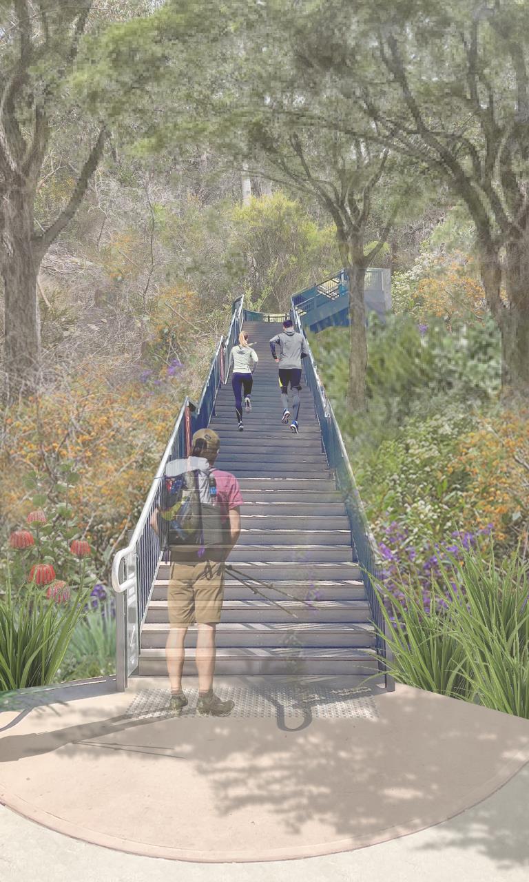
The Botanic Link Walkway forms the final link in the single use link trail for walkers along the northern slope of the ridge, connecting Mt Clarence (Corndarup) + Mt Adelaide (Irrerup) nature trails.
The link between Mt Adelaide, Middleton Beach up to the National Anzac Centre will include a steep climb and is an opportunity to provide a unique natural and recreational experience (similar to Perth’s ‘Jacob’s Ladder’), with steps, landings and panoramic views. The total elevation from Middleton Beach to the summit of Mt Adelaide is 111m.
The significant military heritage attractions of the Mounts and Menang culture will be showcased through interpretation and public artwork. The Botanic Link will boast iconic views of the entire Albany coastline. This offers a unique opportunity to tell Dreamtime creation stories of the country that is visible, in addition to historical Menang use of the place.
Commenced: August 2026
Completion: Due Mid 2027
A key part of the project is the rehabilitation of approximately 1 hectare of unsanctioned trails that have developed over time. These trails will be closed, revegetated with local native species and restored to improve the health of Albany Heritage Park's bushland and protect sensitive granite ecosystems. The project has been shaped through several years of environmental, cultural heritage and technical assessments to minimise impacts on the landscape.
State and Australian Government environmental clearing approvals were finalised in December 2024 following an extensive assessment process. As part of these approvals, 22 hectares of Albany Heritage Park will be permanently protected and managed as an environmental offset for any residual impacts of the project.
More information can be found in the Albany Heritage Park here: Offset Strategy
Using the Trails
The Mounts Trail Network is a shared space for walkers, riders and visitors to enjoy Albany Heritage Park’s unique natural, cultural and historical landscape.
By following the Trail Code of Conduct, walking and riding safely, and caring for the surrounding environment, everyone can help keep the trails safe, welcoming and sustainable for future generations.
Vehicle Access + Parking
The Mounts Trail Network has multiple trailheads and parking areas, making it easy to access walking trails, mountain bike trails and shared-use paths from a range of locations across Albany Heritage Park. Whether you're heading out for a short walk, a family ride or a longer trail adventure, there are convenient entry points close to key attractions and lookouts.
Before your visit, view the Vehicle Access & Parking Map to find the trailhead, parking area and access point that best suits your planned route.
Funding + Partners
This project has been funded by:
- Government of Australia Department of Industry, Science and Resources
- Government of Western Australia Department of Regional Development
- City of Albany
Contact
For more information on the project contact the Major Projects Team at [email protected]
Documents
Mounts Trails Project Update - September 2026
Mounts Trails Network Map
Trails Code of Conduct
Vehicle Access and Parking Map
FAQs
Who can use the trails?
The network has been designed for a range of users and abilities, including:
- Walkers
- Beginner, intermediate and experienced mountain bike riders.
- Families.
- Recreational cyclists using the shared-use paths.
Trail difficulty ratings are provided at trailheads and on trail maps.
Are walkers and mountain bike riders seperated?
Yes. Most walking and mountain bike trails are single-use, meaning they are designed specifically for either walkers or riders. Shared-use paths are clearly signed and are suitable for both pedestrians and cyclists.
What are directional trails?
Directional trails are one-way trails designed to be travelled in a single direction. They are commonly used on mountain bike trails to improve safety, reduce conflicts between riders, and create a smoother riding experience. Always follow the trail signage and ride in the indicated direction
Why are some existing trails being closed or rehabilitated?
What is the trail terrain like?
The Mounts Iconic Trails Network includes a variety of trail surfaces and gradients to cater for different users and abilities.
|
Trail type
|
Terrain
|
|
Walking trails
|
Natural bush tracks with compacted gravel, granite surfaces, steps, uneven ground and moderate to steep sections. All walking trails on the Mounts are Grade 3 walking trails and require a moderate level of fitness and some bushwalking experience.
|
|
Mountain bike trails
|
Purpose-built track featuring compacted dirt, granite rock, berms, rollers and technical features depending on the trail grade.
|
|
Shared-use trails
|
Sealed or compacted trails suitable for walkers and cyclists.
|
Trailhead signage and maps indicate the grade and difficulty of each trail so visitors can choose a trail that suits their experience and mobility.
How do I report a problem with the trails?
If you notice damaged infrastructure, fallen trees, erosion, signage issues or any other maintenance concerns, please report them through the Antenno app. Antenno allows you to report issues directly to the City of Albany and include the location and photos of the issue. For more information or to download the app, head here