Community advertising on a draft Woolstores Precinct Structure Plan.
A Precinct Structure Plan means ‘a plan for the coordination of future subdivision, zoning and development of an area of land’.
The proposed Woolstores Precinct Structure Plan is divided into two precincts, a ‘Woolstores’ precinct and a ‘Commercial’ precinct. The intent for the ‘Woolstores’ precinct is to create a prime visitor destination, inclusive of hotel, with a lively blend of entertainment, cultural, commercial, retail and residential uses within a waterfront environment. The intent of the ‘Commercial’ precinct is to be an employment generator at a neighbourhood scale, with, high quality medium to large format commercial development, while providing a safe and inviting urban environment for pedestrians and workers fronting onto Woolstores Place. There may also be the opportunity for a supermarket for the local catchment, based on demand.
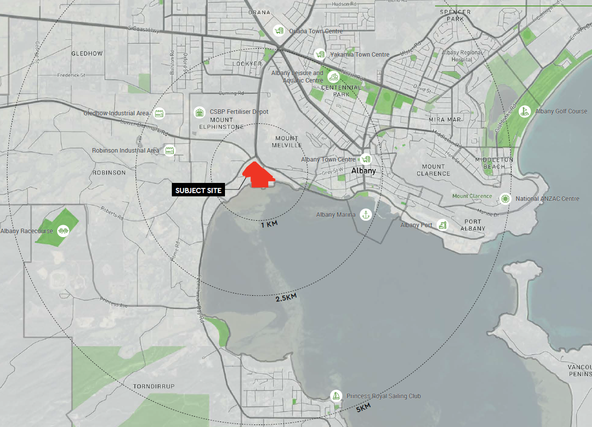
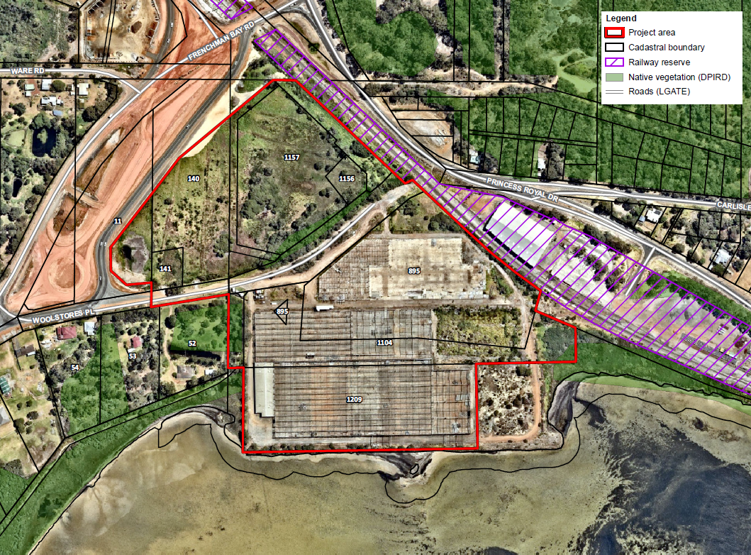
Structure Plan Area
Background
Land within the structure plan area is partly zoned ‘General Industry’ and ‘Rural Small Lot Holdings’ and partly reserved ‘Parks and Recreation’ and ‘Local Road’.
The City’s Local Planning Strategy 2019 states:
The Wool Stores coastal proximity may offer opportunities for transition to mixed-use development optimising the waterfront location.
Investigation Area 2 – Wool Stores
Facilitate the preparation of a structure plan that shows how the site can be redeveloped and addresses the following matters:
- potential mixed-use development, with a focus on tourism;
- connection to sewer;
- coastal planning considerations;
- land contamination considerations;
- visual/landscape protection;
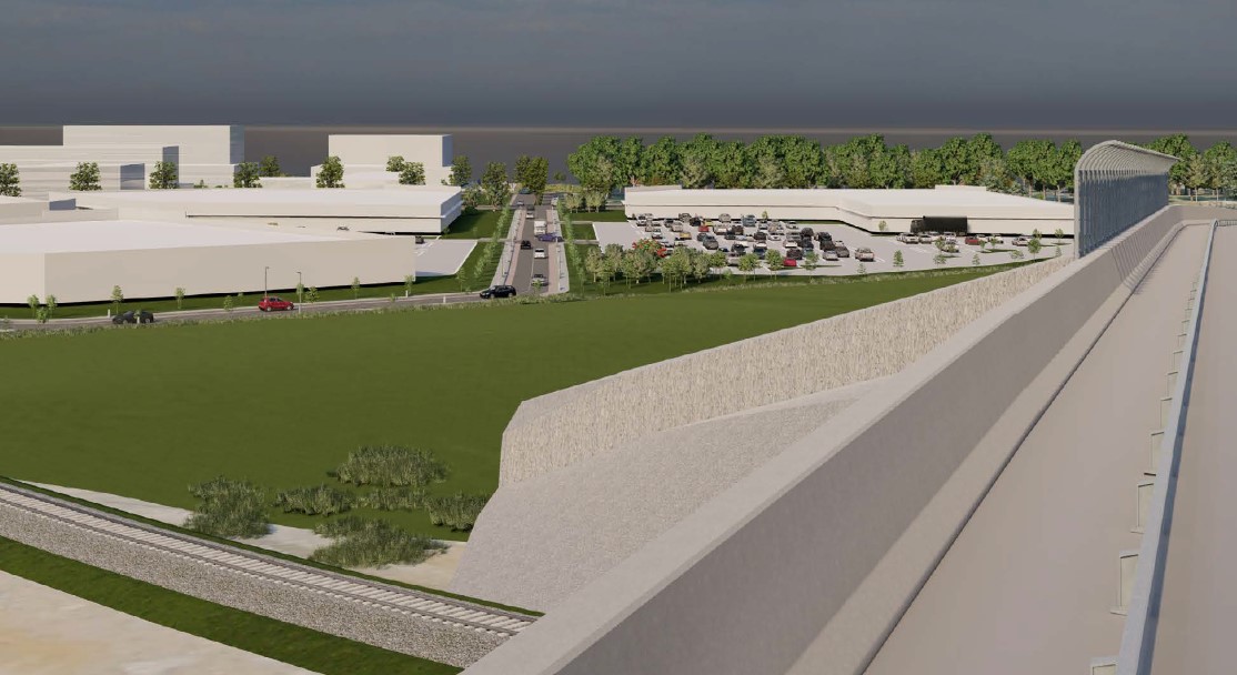
- the interface with the future Albany Ring Road;
- potential impacts of noise and vibration from the railway line and associated environmental buffer requirements; and
- any other requirements that may be determined by the City of Albany or State government agencies.
Documentation
The following is the draft Woolstores Precinct Structure Plan
Draft Woolstores Precinct Structure Plan
The following documents have been submitted to support the ‘Woolstores Precinct Structure Plan’:
Advertising / Submissions
On receipt of a structure plan, the local government must advertise the proposed structure plan for a minimum 42 days.
The City has undertaken the following advertising measures:
- Notification on the City’s website
- Documentation available at the City’s administration building
- Notice published in the local newspaper
- Letter to agencies and landholders
- Comments via an online submission tool
The advertising period closed on the 6 October 2023
To ensure concerns and aspirations are understood and considered, City of Albany Officers are available to explain the structure plan and to answer questions (phone 68203050, Email [email protected]).
Summary
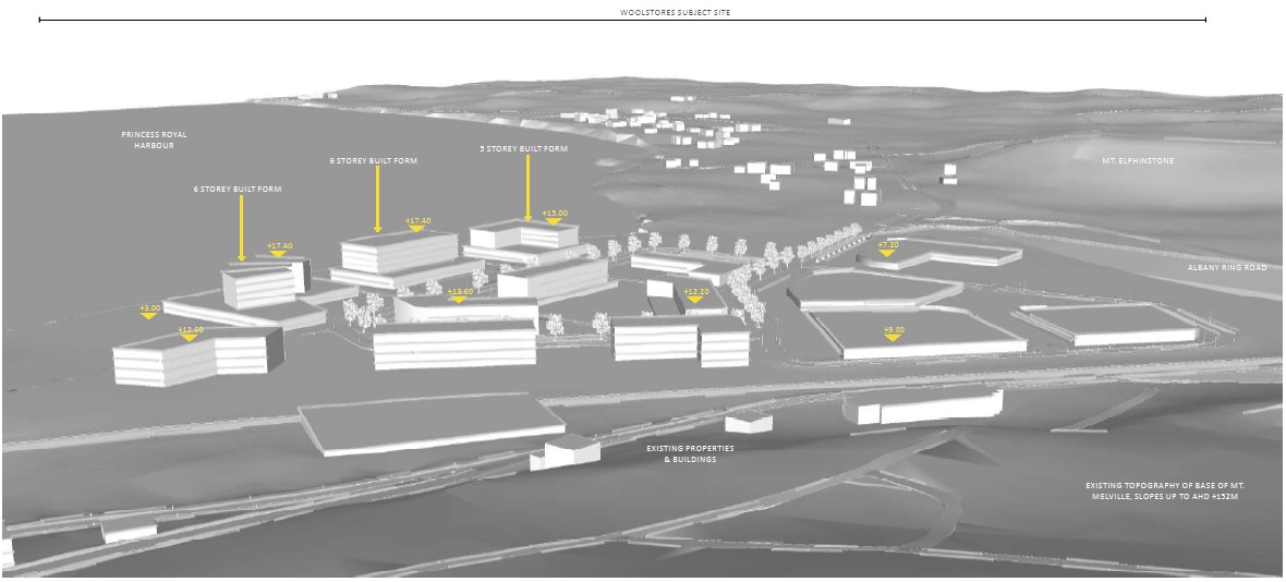
The below figure illustrates the proposed structure plan area and proposed land uses:
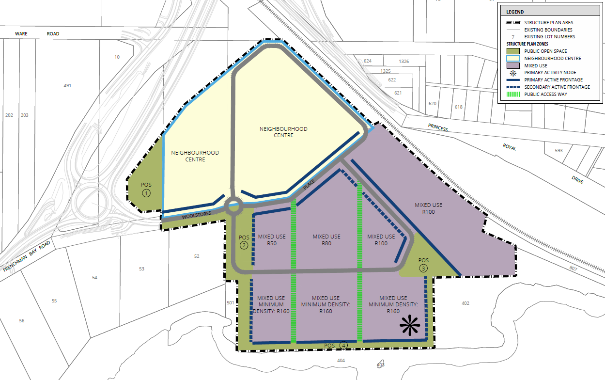
- The structure plan is seeking to create a ‘Neighbourhood Centre’ classification and a ‘Mixed Use’ classification. The neighbourhood centre classification predominantly allows for shopping and the mixed use classification predominantly allows for housing, offices, showrooms, amusement centres, eating establishments and appropriate industrial activities which do not generate nuisances detrimental to the amenity of the district or to the health, welfare and safety of its residents.
- The structure plan is seeking to allow housing density up-to 160 dwellings/hectare.
- The structure plan is seeking to allow development up-to 8 storeys fronting the harbour foreshore.
- The structure plan is recommending housing incorporate noise mitigation measures where necessary.
- A Coastal Hazard Risk Management and Adaptation Plan completed for the structure plan is recommending protection works (sea-wall) adjacent to the foreshore to mitigate against coastal processes, including sea-level rise and storm events. Funding and ongoing maintenance of the seawall is proposed to be undertaken by the applicable developer, in collaboration with the Public Transport Authority, ARC Infrastructure and Main Roads Western Australia. The structure plan proposes that the land is filled to a minimum 2.5m AHD to avoid inundation risks.
- Public Open Space has been identified throughout and includes areas for managing storm-water and a 10-metre-wide area fronting the foreshore.
- Development is proposed to be connected to the Water Corporations sewer network.
- Saltmarsh vegetation aligning with key criteria of the Subtropical and Temperate Coastal Saltmarsh TEC/PEC was observed adjacent to, but outside of, the structure plan area.
- Reporting for the structure plan has recommended further analysis on potential onsite contamination and management of acid sulfate soils.
Reporting has indicated the potential of historical uncontrolled fill being of poor or contaminated quality that will require detailed geotechnical surveys.
- It is proposed that the management of storm-water quality on site will be achieved via the treatment of the first 15mm of runoff from both road reserves and hardstand areas. A gross pollutant trap will be fitted at the piped discharge point to the coast.
- It’s proposed that fill requirements will be driven by the requirement to provide suitable clearance to groundwater, respond to inundation risks as identified above, and free outfall to the coast during major rainfall events.
- Reporting has indicated the need to protect view sheds from Mt Melville lookout, Rushy Point and Princess Royal Harbour. The urban design and built form outcome will need to respond to the key views of the subject site.